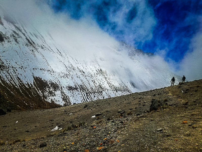
The twin peak volcano is located about 1-hour 30-minutes south of Quito on the road that goes past Machachi and through the small town of Chaupi. There is an access control point where the guards will take your details to sign you in and hold onto an ID. They will also ask if you are going to the south peak, north peak, or refuge. This is because the climb to the south peak can only be done with a licensed guide and the appropriate gear for glacial terrain. The north peak is easier to climb but the guards ensure you have the correct footwear and also insist on a guide. If your destination is the refuge, then the guards will simply ensure you have dressed adequately and let you through. The control point is open from 8 AM to 3 PM and you must sign out by 5 PM. The skies are normally clear in the morning and the clouds begin to creep in by the afternoon so I’d advise getting there as soon as it opens. If you do choose to climb the north peak, I’d recommend getting a guide as the trail is dangerous and many tourists have had accidents. The south peak is also infamous for claiming the lives of foreign climbers, so be warned, it is no easy feat.
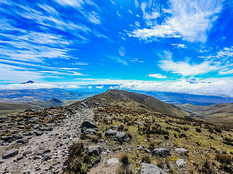
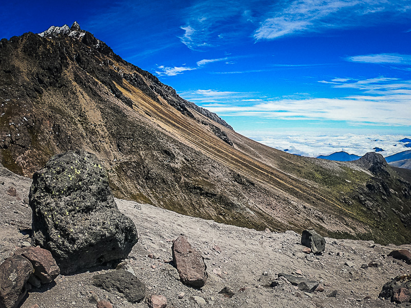
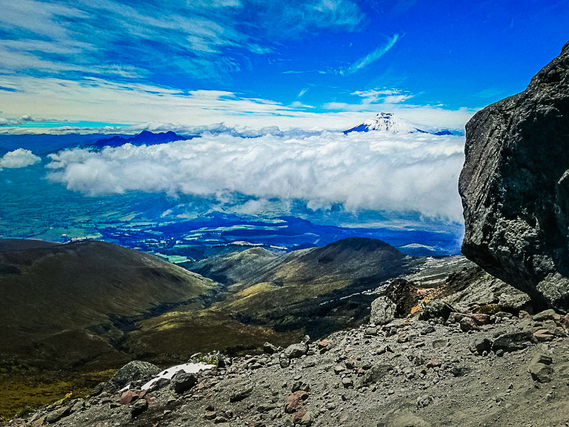
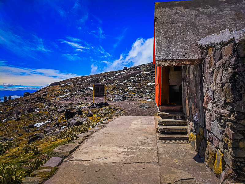
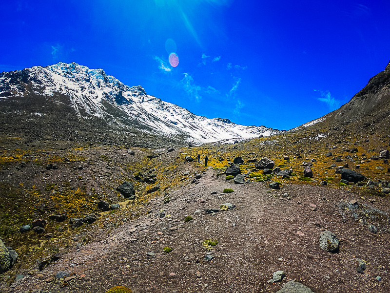
To get there, you can take a bus to Machachi and then hire private 4×4 transportation there. The driver will drop you off at the start of the trail for the refuge and you can agree a time to be picked up. The trail leading up to the refuge takes around 2-hours 30-minutes depending on your skill level. The trail starts at an altitude of 3950 meters and is easy to follow thanks to the many signs showing the way. After about 1-hour 30-minutes, the dirt path begins to turn into a gravel path and it becomes more difficult to ascend. Depending on the time of year, you may come across patches of melting ice and snow. There are also several viewpoints of the landscape and given that its a clear day, you will be able to see the volcanos Cotopaxi, Rumiñahui, Pasochoa, and Corazon. Even if it’s partially cloudy, you may see the volcano peaks rising above the clouds; a truly magical sight.

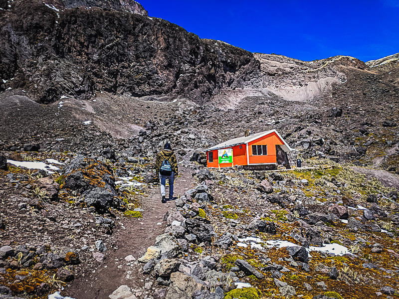
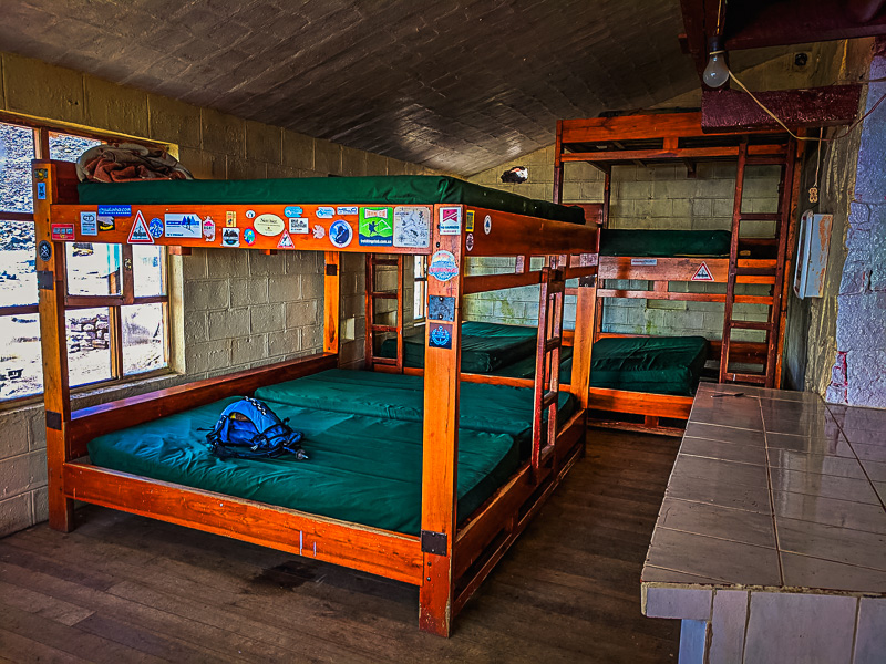
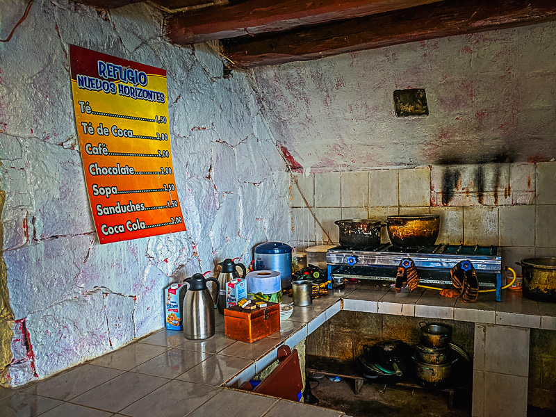
The refuge is a rustic cabin at an altitude of 4750 meters so it’s a lot colder and windier up there. The guards at the control point let us know that the cabin may be empty when we get there and we can let ourselves in. The door is a little stiff so it seems locked but you just have to give it a good shove. Inside the cabin, there’s a kitchen with a stove, water, tea, coffee, and seating area. There are several beds there as well for those who stay the night to climb the south peak the following morning. On the wall, there is a list of prices for anything you make yourself and there’s a metal piggy bank to pay for it. We packed a couple of snacks and ingredients to make a tuna sandwich. So we just paid for some tea and coffee and used the utensils to prepare our sandwich. The restrooms are in the same building but you have to go outside and turn the corner to get to them.
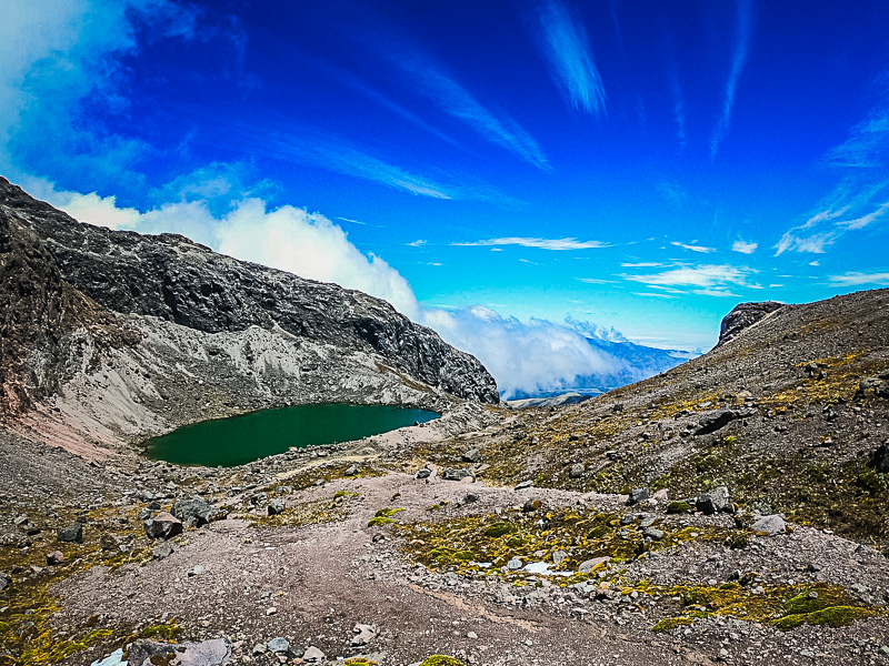
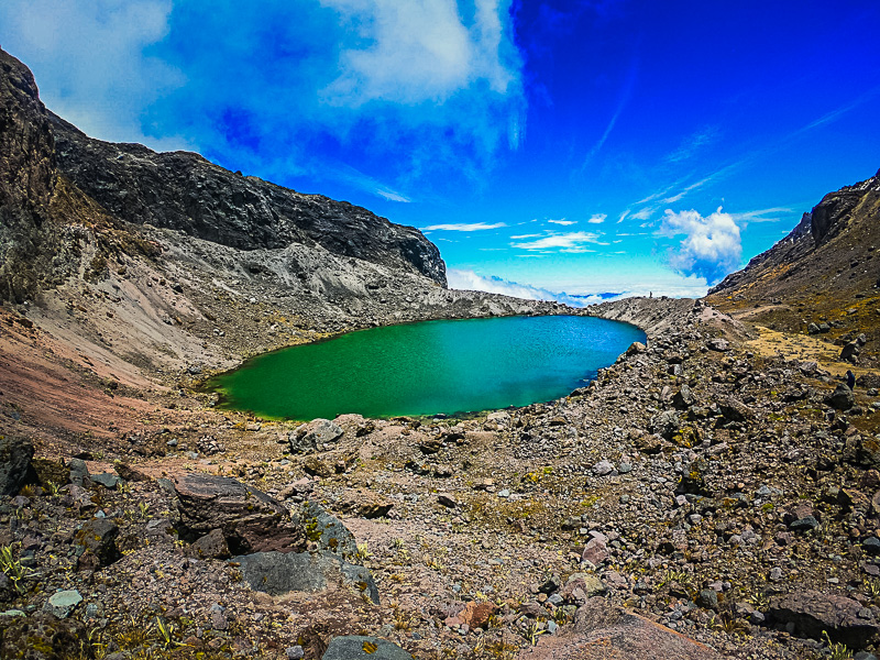
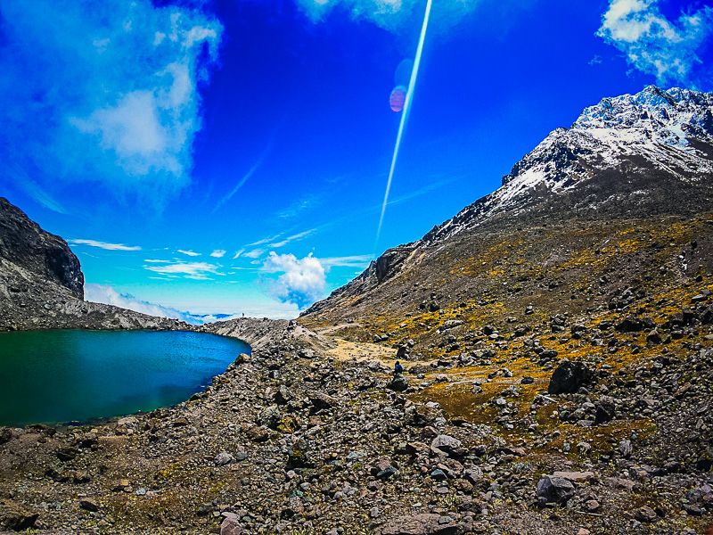
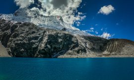
Most people don’t know that there is a small lake 30 minutes away from the refuge on the other side of the mountain. To get there, you start following the trail that goes towards the north peak. You’ll then see the trail that leads directly to the peak, and to the left, there’s another trail that bends around the mountain. It may not look like much of a trail, but if you follow this for 20 minutes you’ll get to the lake. You’ll be able to see the north and south peaks from behind the mountain from here and makes for great pictures. By this point, it was noon and the clouds had moved in on us. It’s never a good idea to climb a mountain in the fog so we decided to go back down.