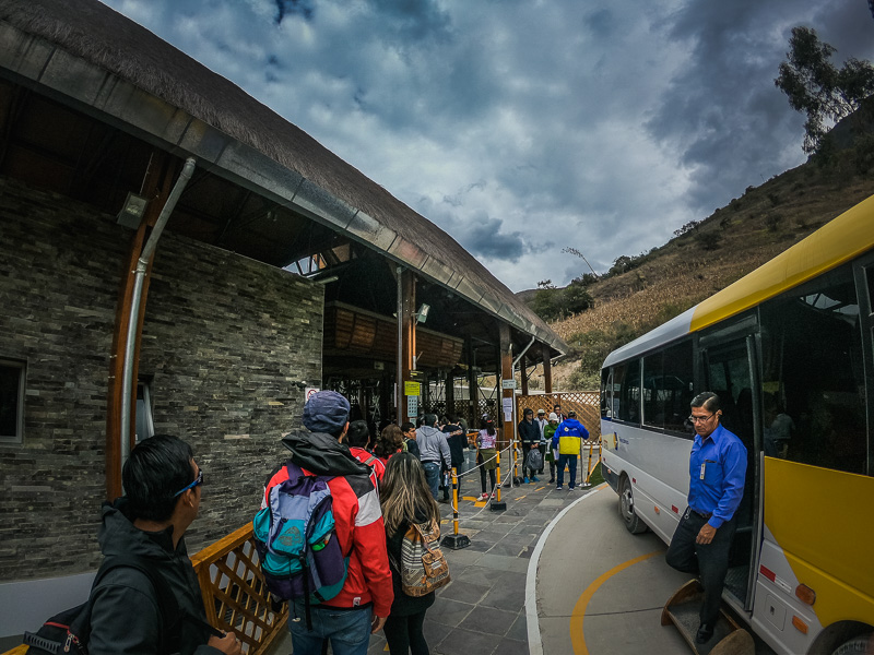
It is possible to get to Kuelap without a tour but when it comes to ruins and history, I prefer to go with a guide. There are several tour agencies in Chachapoyas offering tours to Kuelap. We chose to go with Santa Maria Travel and Tours located in the Plaza de Armas. The tour included a guide, entrance ticket, cable car ticket, and lunch for 80 PEN1. The tour departs at 9 AM from a small bus terminal 4 blocks away from the tour agency’s office. Since we had a bus to Trujillo at 7.30 PM, we needed somewhere to leave our backpacks and the agency staff let us store them in the office while we went on the tour. There were around 25 people in our group and we all boarded a 35 person bus which took around 1-hour 20-minutes to get to the town of Nuevo Tingo. It is a short drive to the cable car ticket office from here and if you’d come on your own, there are taxis available to take you up or you can walk uphill. The restaurant where lunch is held is also here and everyone goes in to put down their order from the options. The included dishes are those in the standard ‘almuerzo’ which includes a soup; main of either chicken, beef or fish; and a freshly pressed juice. If you want something a la carte, then you have to pay extra. After placing orders, the group gets around 20 minutes to use the restroom, walk around the plaza, or buy any snacks from the local shops before boarding the bus again to go up to the cable car ticket office.
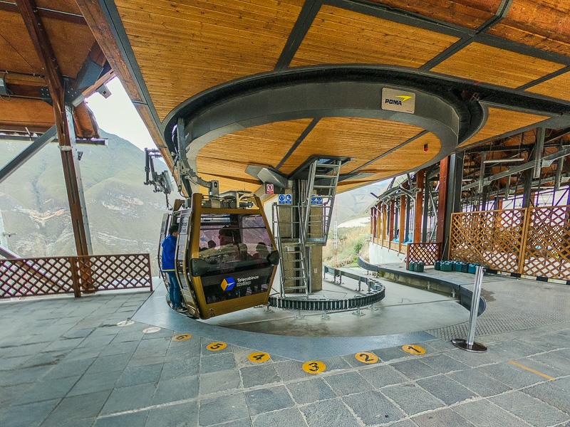
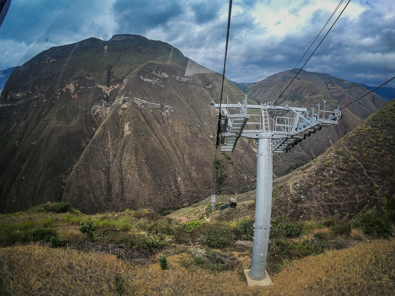
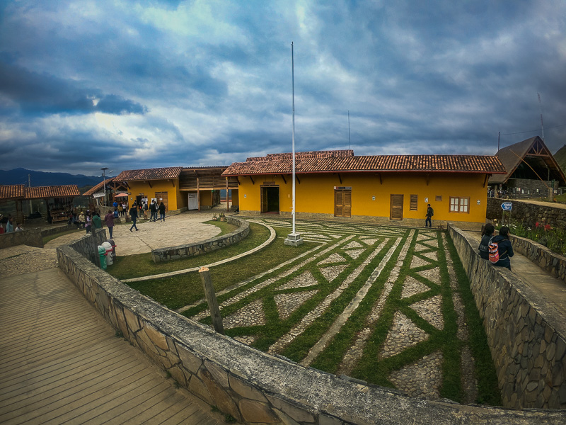
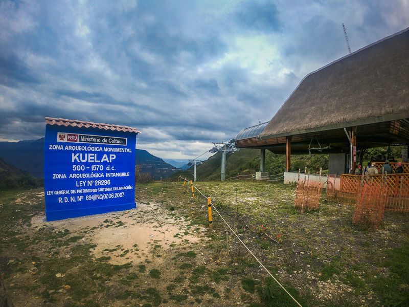
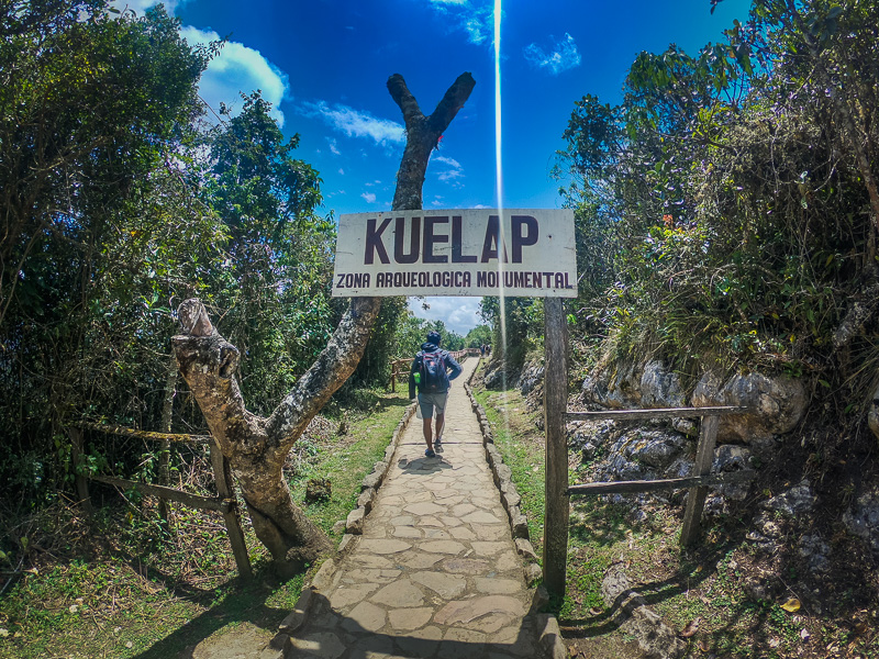
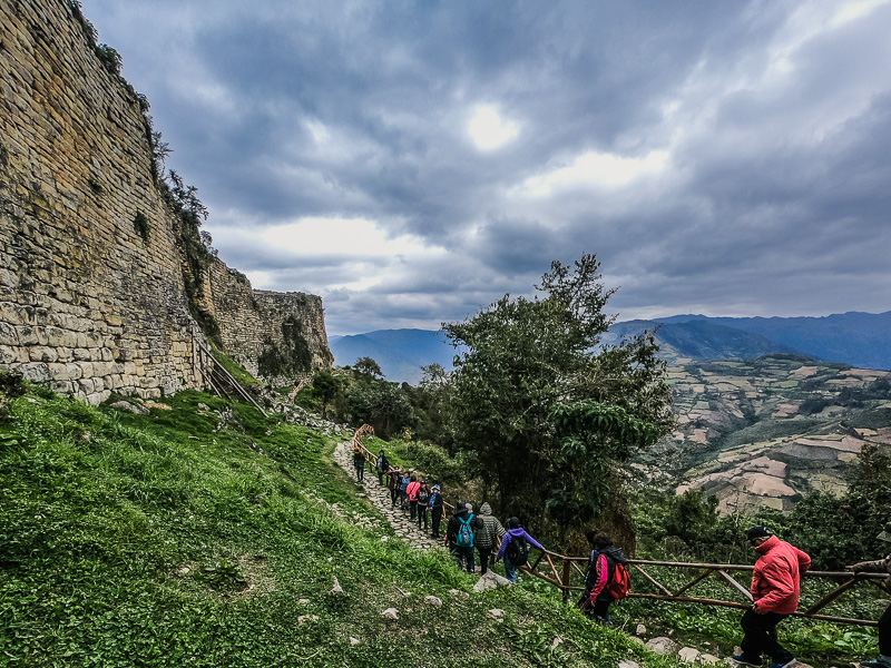
At the cable car ticket office, the guide goes to get the group tickets and distributes them to the group. The tickets are by time slots so we have to wait for our slot. There are several information panels about the project to build the cable car to Kuelap. There are also great views although it was quite windy and chilly so we mainly waited inside. After about 20 minutes they called our timeslot so we queued up and boarded another bus which takes you 10 minutes up to the actual cable car stop. The ride on the cable car takes 20 minutes and takes you to 3000 meters above sea level the visitor center. The guide will get the tickets and distribute them to the group. Meanwhile, you can check out the visitor center, use the restroom, and buy some snacks. It is then a 20-minute walk uphill to the fortified city but there is also the option to rent a horse. We made it up by 12 PM, and since we got there earlier than the rest of the group, we had some more time to take pictures.
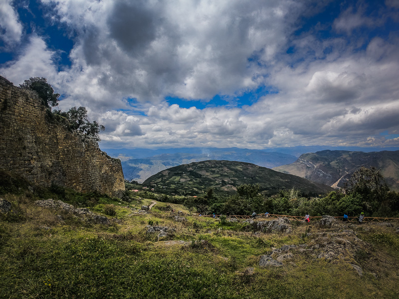
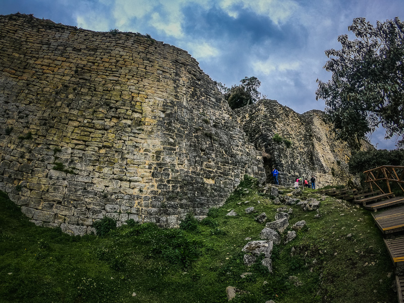
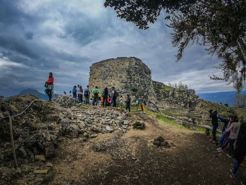
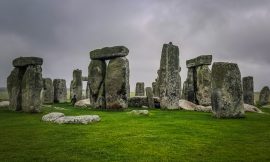
Once the group reconvened, the guide gave us a brief history of Kuelap. He told us the original name of the city was ‘Conclave’ which means ‘city over the mountain’ but as the Archaeologists carried out their work they changed it to Kuelap. With regards to its discovery, he said it was found in the year 1843 by a judge who resolved land disputes in the area. He came across it by chance but the locals had already known about the area but not its significance as an archaeological site. The judge Juan Crisóstomo Nieto was the one who gave it its importance and registered it with the local authorities. In 1870 the famous Italian scientist and geographer Antonio Raimondi visited the site to study it and since then, several foreign and local archaeologists have investigated the site. Currently, only 15% of the site has been archaeologically excavated. Next, he spoke about the height of the wall measuring between 18 and 20 meters high. He mentioned that the walls aren’t straight but rather wavy. They were built this way due to their height otherwise they would have collapsed.
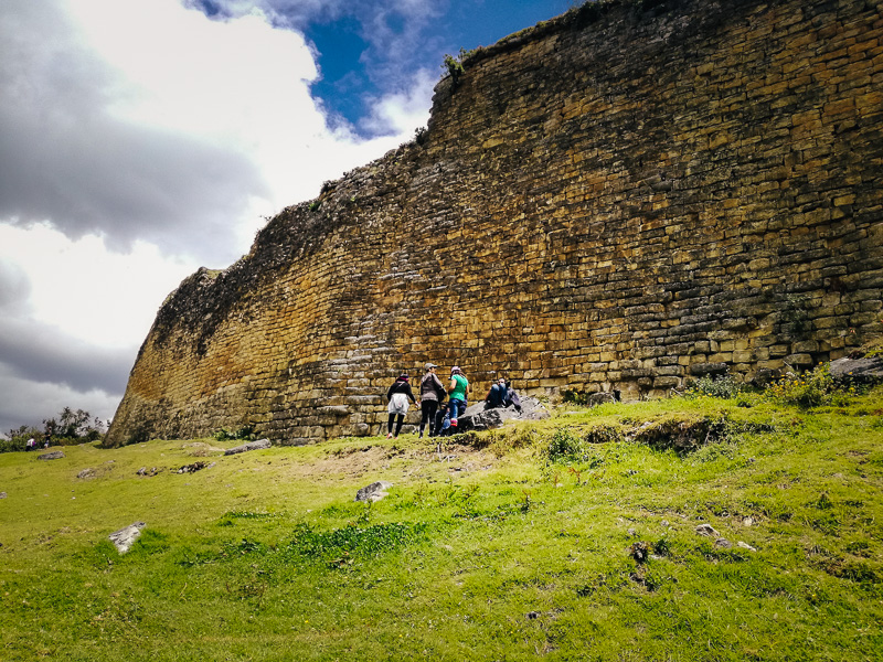
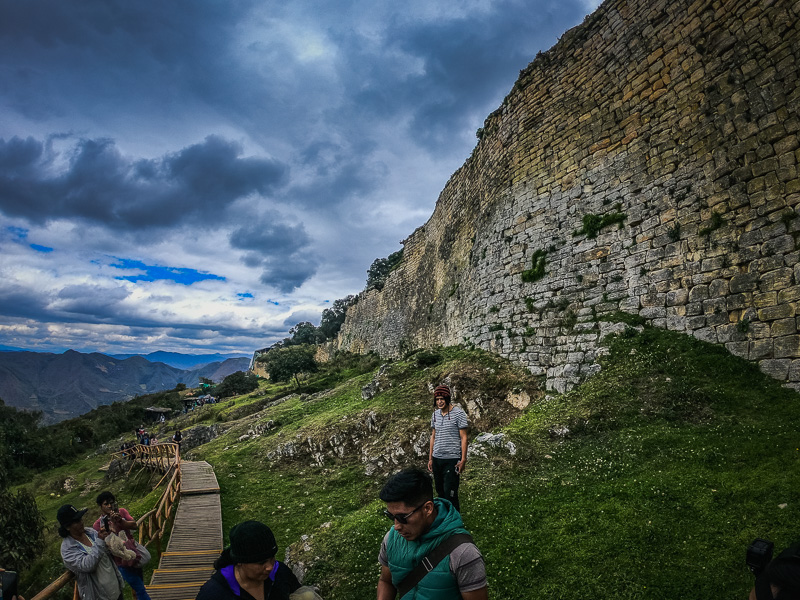
He also pointed out the lighter yellow color of the wall and mentioned it is the original color. The color has darkened over time due to the weather. The method used to build the wall was to dig into the mountain, then level out the land, and finally place stones to hold the soil up. The stones were sourced locally since the mountain is a quarry. Unlike the precision cut Incan walls, these were put together using a cement-like mix made from another stone. He said construction was estimated to have started at around 400 AD. After walking another 5 minutes to the right of the walls, we arrived at the secondary entrance since the main entrance was closed due to part of the wall collapsing which has uncovered human remains. There’s a panel there illustrating the rather unique entrance. It’s initially 3 meters wide and then 60 meters further down, it narrows down to 1 meter wide. So when entering, 3 people can go in but it funnels down to one person. It was designed this way to help defend from attacks.
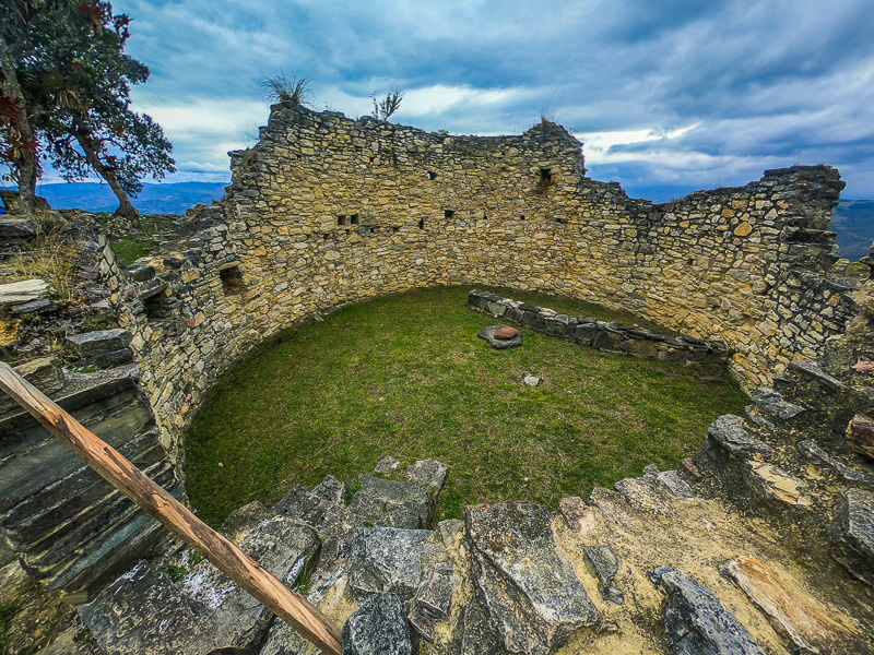
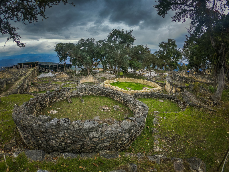
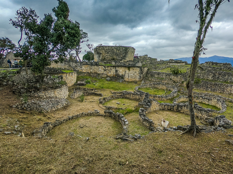
After climbing a couple of stairs from the entrance you arrive at a rest area where the guide spoke to us about the people native of the area. The Chachapoyas were a group of 7 local tribes who fought between themselves for territory and resources but then came together in a stand against the Incas. However, this alliance didn’t last very long due to selfish leaders. The Chachapoyas built circular structures and the small ones are around 4 meters in diameter. The big ones were 13.5 meters in diameter. The small ones were houses, whereas the big ones were used as guesthouses for merchants who came to trade. The houses were 8-9 meters high and had straw cone-shaped roofs. There are over 500 houses and believed to have housed around 3000 people at its peak. Next, we continued further up to arrive at an area known as ‘Pueblo Alto’ where the North Tower is located.
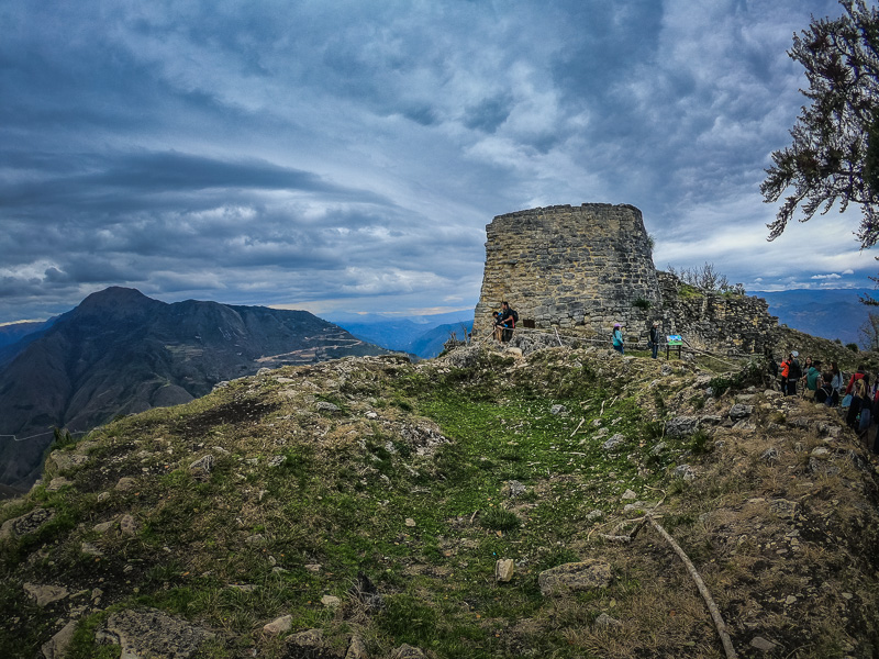
The tower takes the form of a D and is 7 meters high with a half circumference of 5 meters. Initially, it was thought to have been used for defenses due to weapons found in the area. However, later excavations discovered 25 human remains and artifacts. The Chachapoyas believed in another life after death so a location to preserve bone remains was important since they believed if they remained here, they would be fine in their next life. The remains are also facing east where the sun rises; and to the west, there is an unobstructed view of the highest mountain in the area which was of religious importance – Cerro Santa Clara. Therefore, it is now thought to be a sacred spiritual burial ground of important people. The guide then went on to speak about the Incas who came in the 1420s. They endured 3 failed attempts to conquer Kuelap due to the alliance of the Chachapoyas. However, by 1470, the alliance had begun to weaken and some of the Chachapoyas leaders became allied with Huascar whilst others sided with Atahualpa. A Guaman of the Chachapoyas was an intelligent influential individual who was skilled in obtaining valuable information. One of these Guamans gathered intel on Huascar and gave it to Atahualpa which helped him defeat his brother Huascar in the region. As a reward, Atahualpa made the Guaman the chief of the region which included Kuelap. Now that the Inca were in power, they used their tactic of assimilation where they brought their best people from their empire to Kuelap and sent Chachapoyas people to other regions of their empire. In this way, they were able to enforce their norms and reduce the possibility of rebellions.
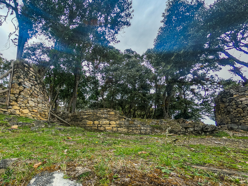
Continuing on the tour we come back across the Incan part of Kuelap. La Callan is one of the few Incan rectangular structures introduced in assimilation. It has four entrances and measures 25 meters in length and 8 meters wide. It was used for sacred religious Incan ceremonies. The roof was of the same style as the Chachapoyas structures. There are a couple more of these structures in ‘Pueblo Alto’ but this one is the biggest. Continuing down the path, we go back down some stairs to leave ‘Pueblo Alto’. Here we come across many circular houses of the Chachapoyas. Some of them have three diamond outlines which were symbolic of one of the Chachapoyas gods – the feline puma.
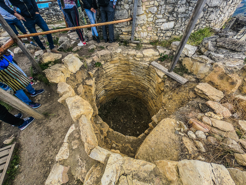
In the layout of the houses, there was a river stone which was used for food preparation. There was also a division to hold the cuys (guinea pigs) to conserve their heat. These animals were not only eaten but also used for healings. The windows were used to store ceramics and utensils. There was also a second level where they would store corn and dry foods. In the center, there was a stone which marked a hole that was 1 to 1.1 meters deep. One theory is that this was used to store corn. The other theory is that it was used to bury family members since human remains had been found in them. The house doors faced each other onto the main pathway. They were built in two levels with a raised walkway known as an ‘arera’. The house entrance was a step up from the ‘arera’ so when it rained, the water would run down to the main pathway and not into the house. Following the path further, we come across the main entrance which was closed at the time due to the excavations being carried out following the collapsed wall. A restoration project of the houses was halted due to this excavation and will continue once the studies of the human remains and artifacts have been completed.
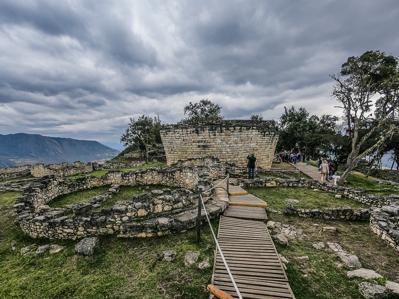
At the southern end of Kuelap, we find Templo Mayor which has a shape of an upside-down cone like a cup. The bottom diameter is 11 meters and widens to 13.5 meters at the top. It is 5 meters high and the roof is flat but it also used to have the cone-shaped hay roof of the other structures. There’s a hole in the roof so you can see the inside is hollow. One theory is that this was a prison where people were thrown inside since human remains have been found. However, following recent studies, it is believed this was a ceremonial site hence its name. One of the stones also has the face of a monkey engraved in it which holds religious significance to the Chachapoyas. Corn was also found on the left side which symbolizes an offering as well as many religious artifacts.
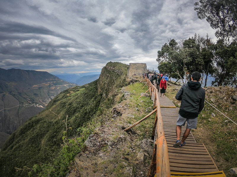
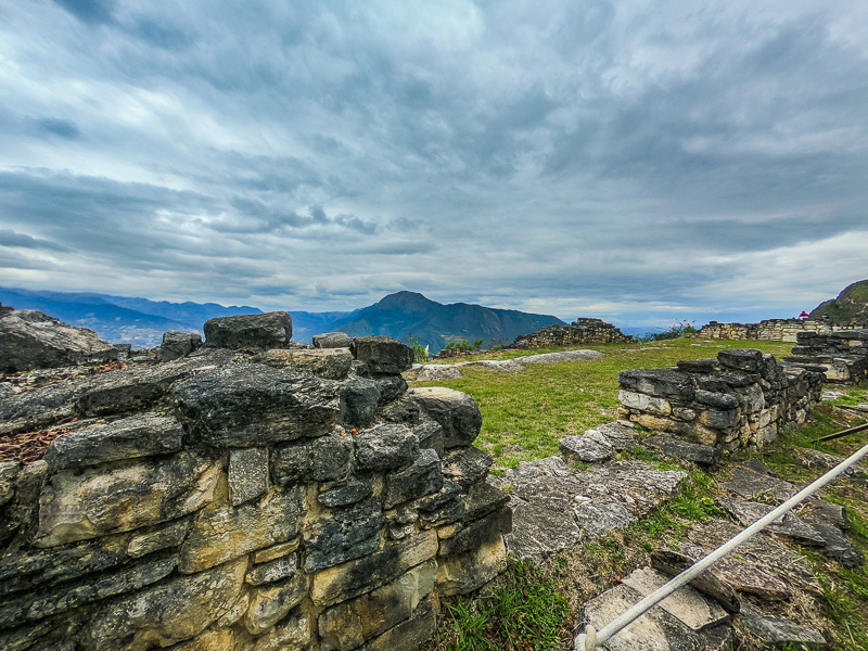
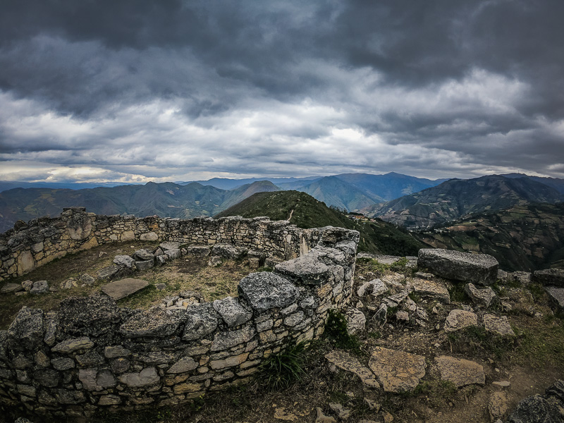
Other than human remains which seem like burials, there are also 3 human remains which have signs of being beaten by weapons of the time. This helps corroborate the first theory of the abandonment of Kuelap which manifests that the Chachapoyas had internal feuds resulting in the deaths of these three warriors and thus the abandonment of Kuelap. The second theory is during the Spanish conquest, the Chachapoyas confided in them thinking they would be better than the Incas. They invited the Spanish to Kuelap but they brought disease resulting in an epidemic that took over Kuelap. Therefore, to end this epidemic, they killed all the residents and burnt down Kuelap. The third hypothesis is with regards to the Spanish conquest’s search for gold and silver. To avoid the Spanish using the fortified city of Kuelap, the Chachapoyas burnt it to the ground and relocated to neighboring regions. Walking past Templo Mayor, there is a platform which looks out to the south of the Mountain. There is also a house here which may have belonged to whoever stood guard at this end of the city. This is the end of the tour and the group exits via the western exit which loops round taking you back to the southern point of Kuelap where we started. From here we hike back down to the visitors center and then return to Nuevo Tingo for lunch. We were back at the restaurant around 3.30 PM and the waiters showed us to the group table and served lunch. Following lunch, the group boarded the bus and we were back in Chachapoyas around 5 PM.
